
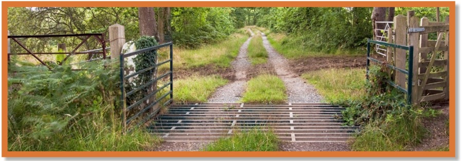
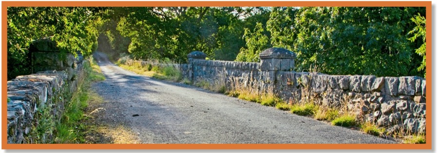
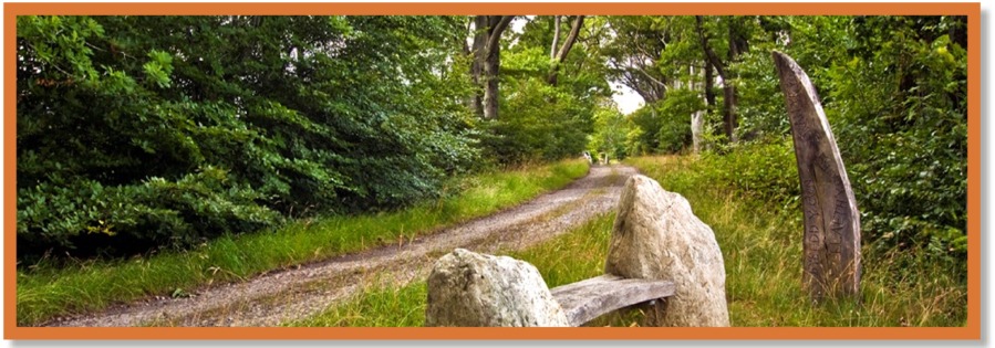
Paths
Llanystumdwy Community Council
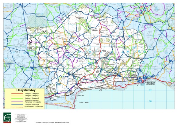
Some of the popular paths in the community of Llanystumdwy
| 1. | Y Lôn Goed. This path starts at Afonwen and it can take you all the way to Hendre Cennin. It is famous because of the trees which were planted either side by John Maughan, stewart of the Talhenbont/Plas Hen Estate. The reasoning being that the trees would help drain the land making it easier for the farmers of the estate to carry lime from the kiln at Afonwen to the different farms and therefore improving the land. Map Ref. 4347 – 4543. |
| 2. | From Afonwen you could join the coastal path, either towards Pwllheli or towards Llanystumdwy. Towards Llanystumdwy it follows the main road before leaving the road to go through Abercin farmyard to the river Dwyfor estuary and then following the path above the beach towards Cricieth. Map Ref. Start 4337. |
| 3. | You could wander off the coastal path at Bont Fechan and follow the path towards the river Dwyfor estuary, across the river to the above path. But you would have to re track back to Bont Fechan as it is impossible to cross the river! Map Ref. 4638. |
| 4. | From the village of Llanystumdwy you could follow the path that starts by the grave of D Lloyd George along the Dwyfor riverside, through Trefan Woods up to Rhydybenllig Bridge. It is a popular path which can become muddy when the river overflows. Map Ref. 4738 - 4840. |
| 5. | If you don’t have too much time to spare, what about following the road from Llanystumdwy past the entrance to the grave of D Lloyd George. Turn right at the end of the road, past Tŷ Newydd Writers’ Centre, where Lloyd George spent his final years, before following the path back to the main road between Llanystumdwy and Cricieth. Map Ref. 4738. |
| 6. | If you have enjoyed so far, what about following the main road towards Cricieth, past Caellobrith Terrace, and then when you reach Ynysgain Lodge, cross the road, bear left and follow the Ynysgain Bach path UNDER the railway into the parish of Cricieth. You could carry on, turn left and follow the path which brings you into Cricieth, either joining the coastal path or out by the Guides’ headquarters at Muriau. Map Ref. 4838. |
There are a few popular paths around Llangybi as well.
| 7. | The path to the summit of Garn Bentyrch.. You could park either by the sign for the well or in the vicinity of the church and follow the signs for the well. There will be new interpretation boards in place soon. After viewing the well, proceed through the gate and straight up the official path to the summit of Garn Bentyrch. On a clear day you can see for miles towards the Rivals, Snowdonia or even the coast of Llŷn and across the sea towards Harlech and further afield. Map Ref. 4262. |
| 8. | It is possible to follow this path back to the well, bear right and go towards the bridge. This path will take you to nearby Ysgol Gynradd Llangybi. Map Ref. 4140. |
© 2026 Copyright Llanystumdwy Community Council (Website by) Delwedd - Thank you to Mr Eryl Jones for some of the photos.